
 |
| Natalie and Em rocking down our Trimble GPS base station. |
 |
| Drew and Natalie start up the Trimble for the day. |
"Thanks Emma!"
A Global Positioning System (GPS) works through the communication between satellites in space and a receiver on the ground. The U.S. Government has 24 satellites which continually orbit the Earth. These satellites are always moving in a precise route, so we can track where they are at a specific time. On average, a satellite orbits the Earth two times per day at about 7,000 miles per hour.
To collect high-precision geospatial data we first need to set up a base station. We set up our base station uphill from our Mt. Discovery camp where it had a clear view of the sky. This unit always stays running in the same position, level to the ground. The base station constantly communicates with satellites in orbit using radio frequencies and calculates its exact location. Then when we want to survey a particular feature or point, we set up a rover unit which attaches to a backpack so we can move around with it. This unit also communicates with the satellites. After we are back from Antarctica we can process the data collected by the rover and compare it with the data from the base station. The position of the rover unit is important, but knowing its position relative to the base station, allows for higher precision surveys of points and features.
 |
| Leveling the base station. |
 |
| Completed base station positioned by Mt. Discovery. (Bottom left corner) |
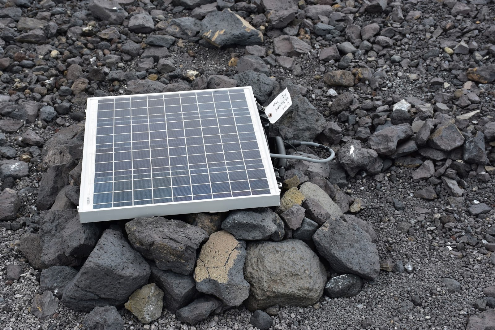 |
| Solar panel that powers the base station.We rocked it down to prevent it from blowing away. |
 |
| Close up of the base station's receiver. |
But how does a receiver station actually measure the distance from the Earth to the satellite when it moves at such a high velocity?
 |
| Drew surveying the moraine with the rover. |
 |
| Natalie and Drew taking a break from surveying to do some shielding. |
"Go for it Em"
"Thanks Nat"
It comes down to math. A simple equation of Velocity x Time = Distance. So, if we know how fast the radio signal from the satellite is moving, and how long it takes to reach the GPS device on Earth, we can find the distance it traveled. It's a really tricky process though, because radio signals travel at the speed of light, and since it only takes about 0.06 seconds for the code to travel from the satellite to Earth, you must use really accurate clocks.
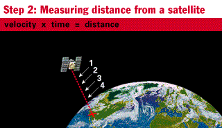
So, since we always know how fast the radio signals are traveling, the key to finding distance is time. As we learned before, the satellite is emitting it's own special pseudo random codes. If the receiver emits the same code, and both start at the same time, they should be in sync, right? Wrong. Because the code has to travel from the satellite to Earth, there is a delay. You can then tell how long it took the code to reach the Earth by how much the two codes are out of sync. When you multiply the delay time (travel time) by the velocity you get the distance. Since we are dealing with such small numbers, the more accurate the clock, the more accurate the measurement will be. The clocks on the satellites are called atomic clocks, and they are very accurate. GPS receiver devices have less accurate clocks, as atomic clocks are very expensive. This inaccuracy is ok because the GPS devices will communicate with multiple satellites, and the errors can be offset. So, the more satellites the GPS can see, the more accurate the timing. The more accurate the timing, the more accurate the distances. And finally, the more accurate the distances, the more accurate the GPS coordinates that we use every day.
 |
| Waiting for the GPS to find itself. |
"Thanks Emma."
GPS, also called NAVSTAR, was created by the U.S. Department of Defense in the late 1970s for military purposes. The first satellite was launched in 1978. Eventually, in the late 1980s the GPS system was released for civilian use. Each satellite produces two pseudo random codes on different frequencies: L1 and L2. L1 codes are more complex and therefore more accurate. It is strictly for military use. L2 has simpler codes and is slightly less accurate. L2 is the frequency we use everyday on our phones, in our cars, and other commerical GPS devices. It's also the one that we use to collect scientific data on our Trimble device.
In 1994 the last satellite was launched into orbit, completing our US constellation of 24 satellites. Each satellite is built to only last about 10 years, so replacements are constantly being constructed and placed into orbit. Each satellite orbits so that five can be seen from every location on Earth.
 |
| The US constellation of GPS satellites. |
 |
| Sample image of a satellite. |
Until next time,
-Natalie Robinson and Emelia Chamberlain
(Research and some graphics from the Garmin, and Trimble websites)
الان يمكنكم التواصل مع كبري شركات سفرك اي انهما تعمل علي توفير الكثير من فنادق تايلاند بانكوك العالمية في خدمات توفير افضل جزيرة في المالديف للذلك يمكنكم الان الاعتماد عليهم جيدا في الكثير من فنادق في كوالالمبور الكبري والمميزة وهم يعمولن جيدا علي افضل فنادق العالمية
ReplyDelete