Today is our last day at our Mount Discovery camp. Tomorrow we will move east to Black Island. We will camp close to Mount Aurora, the highest peak on the island. We have spent our days here collecting lots of samples of granite, dolerite rocks and algae, digging pits, and mapping the moraine. Here are some highlights from our time at Discovery!
 |
| Crazy clouds over Mt Discovery |
 |
| Drew surveys the highest point of the moraine. The GPS rover is attached to his backpack to make it easier to walk with |
 |
| Drew and I work on the GPS as we retrieve coordinates for one of our cosmo samples. |
 |
| Drew reads off compass directions as I take notes |
 |
| A view of the Royal Society Range from the top of "Bab Hill" |
 |
| I take a quick nap on a comfy rock after lunch |
 |
| Part 1 of the Big Rock Photoshoot: Drew strikes a pose |
 |
| Part 2: I lounge with a tape measure |
 |
| Part 3: Emma plays with a Schmidtt Hammer |
 |
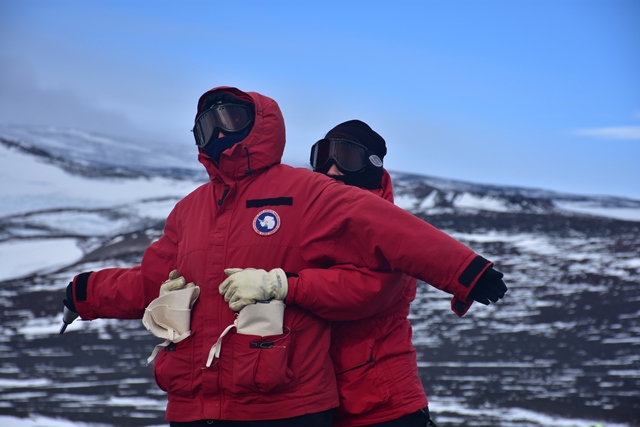
| Part 4: Titanic |
 |
| Drew and I study some ancient algae in a pit we dug. This algae is probably 12,000 years old but stays perfectly preserved in the cold, dry climate. |
 |
| Burrito time in the tent! |
 |
| Our GPS base station and solar panel overlooking our first campsite at Mount Discovery |
 |
| Emma featuring mountain |
 |
| Me featuring mountain |
 |
| Our camp from afar overlooking the Royal Society Range |
 |
| Two sporty ladies and a mountain |
 |
| I hold up the mountains while Emma takes a break to stretch |
 |
| Koettlitz Glacier to the left and Brown Peninsula to the right |
 |
| An eerie Mt Discovery |
 |
| Drew leaves us in the dust (as usual) |
 |
| Resting while waiting for the GPS to find itself |
 |
| ??? |
 |
| Emma touches the peak of the mountains |
 |
| Emma and I fall behind |
 |
| This pond which froze during the winter has started to melt since we've been here |
 |
| A happy camper and an unhappy camper
Until next time!
|
-Natalie Robinson

Great photos. It must have been fantastic camping out there.
ReplyDelete